Vintage Photos Vintage Photos
Take a look at some Hudsons from way back when. Some of these photos lack identification, so if you know anything, please share it!
Recent Photos
Here you'll find Hudson photos taken within the last thirty years.
Flat Creek Map
Here's a map of the area in Missouri where John Brown "Grub" Hudson had his farm, hand-drawn by Mirl C. Hudson.
Documents
Military documents, social security applications, letters and other Hudson history papers can be found here.
Ozark Mountaineers
Mirl, Ruth, Toy, Birt and Dal made up this bluegrass band that toured in California in the 1940's.
Have any photos or other items you'd like to share here? Send them to:

|
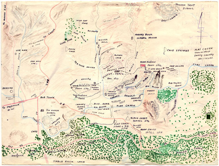
This map of Flat Creek, Missouri, was hand-drawn by my grandfather, Mirl C. Hudson. As far as I know, he drew it from memory sometime in the 1970's. It shows his birthplace, the John Brown "Grub" Hudson farm site, and various geographical features. You will note that he even shows where the moonshine still was! Click on the map to download a larger JPEG file.
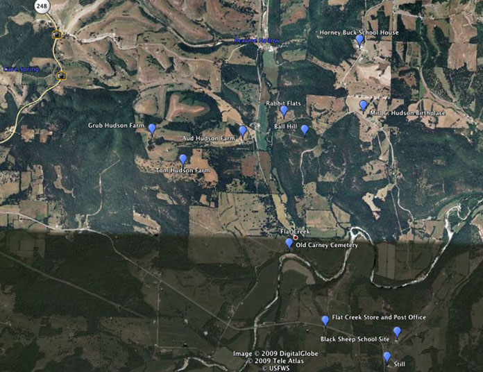
For comparison, below is a satellite photo of the area from Google Earth with some of the possible locations marked.
|